Поиск |
|---|
|
|
Лучшая карта: |
|---|
 Уже скачали: 129322 |
Обновлённые карты и обзоры: |
|---|
[ 10 карт] просмотров 19253 [ 10 карт] просмотров 18407 [ 10 карт] просмотров 18624 [ 7 карт] просмотров 17552 [ комплект] просмотров 12377 [ 10 карт] просмотров 18435 [ 10 карт] просмотров 18751 [ 8 карт] просмотров 18131 [ 20 карт] просмотров 20326 [ 17 карт] просмотров 17430 [ подборка] просмотров 19599 [ 7 карт] просмотров 20335 [ 15 карт] просмотров 20292 [ подборка] просмотров 17437 [ подборка] просмотров 18268 [ вектор] просмотров 2820 [ векторы] просмотров 17717 [ 10 карт] просмотров 18918 [ подборка] просмотров 17611 [ подборка] просмотров 20507 прочитали 5780 раз прочитали 5811 раз прочитали 52089 раз прочитали 6167 раз прочитали 12242 раз прочитали 99995 раз прочитали 6706 раз прочитали 11434 раз прочитали 6603 раз прочитали 6834 раз |
Другие версии сайта | ||
|---|---|---|
 Форма входа |
Картографический авторский проект fedoroff.net 2026 год | Вы
Гость×|
Статьи | Файлы | Альбомы | Новости | Лучшие | Блог | Карта сайта | Контакты |
Статьи | Файлы | Альбомы | Новости | Лучшие | Блог | Карта сайта | Контакты |
| FEDOROFF.NET » ГЛАВНАЯ » ФАЙЛЫ » КАТАЛОГ КАРТ » ВСЕ КАРТЫ |
Map of the Canary Islands
2021
 DOWNLOAD (1.16 Mb)
СКРИНШОТ·
· ФОРМАТ
· Распечатать · Написать автору · Заказать доработку карты
· Последнее обновление карты: 14.Января.2021, 15:28 · Просмотров: 3945 · Рейтинг карты: 264
DOWNLOAD (1.16 Mb)
СКРИНШОТ·
· ФОРМАТ
· Распечатать · Написать автору · Заказать доработку карты
· Последнее обновление карты: 14.Января.2021, 15:28 · Просмотров: 3945 · Рейтинг карты: 264
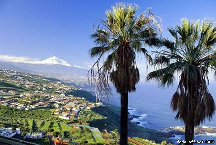
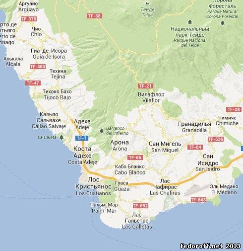 Canary Islands - an archipelago of seven islands of volcanic origin in the Atlantic Ocean, off the northwest coast of Africa across Morocco and the Western Sahara. The islands belong to Spain and are one of the autonomous communities of this country. Canary Islands consist of 13 islands - the seven major Tenerife , Gran Canaria, La Gomera , El Hierro , La Palma, Fuerteventura and Lanzarote , and six small : Graciosa , Alegransa , Montaña Clara, Lobos, Roque del Oeste and Roque del Este. Geographically, the Canary Islands are included in a group of volcanic islands along with the Azores , Cape Verde and Madeira .
 In the Canary Islands two capitals - Santa Cruz de Tenerife and Las Palmas de Gran Canaria, but until 1927 the city of Santa Cruz de Tenerife was the sole capital .
At the heart of the Canary archipelago is the largest and most populous island - Tenerife (Tenerife), an area of 2,057 square kilometers To the west lies the island of La Gomera (La Gomera), an area of 378 square kilometers, El Hierro (El Hierro), an area of 277 square kilometers and Palma (La Palma), an area of 708 square kilometers The island of Gran Canaria (Gran Canaria) is located east of Tenerife - is the third largest island of the archipelago , an area of 1532 square kilometers Further east are the islands of Fuerteventura (Fuerteventura), an area of 1,730 square kilometers and Lanzarote (Lanzarote), an area of 795 square kilometers Of the six small islets only the island of Graciosa (La Graciosa), an area of 27 sq km is inhabited. To the east are the islands Alegransa , an area of 10 square kilometers, Montaña Clara , an area of 1 square km , Lobos, an area of 6 square kilometers, Roque del Oeste (Roque del Oeste) and Roque del Este (Roque del Este). Total - 13 islands .
 Before coming to the Canary Islands were settled by Europeans, they Guanche tribes , which were developed at the level of the Stone Age , they were engaged in cattle breeding and primitive agriculture and were able to mummify their leaders . As the clothes used animal skins . Guanche tribes left behind a pyramid of Guimar - an amazing megalithic monument of architecture.
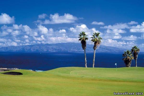
The climate is tropical Canaries , moderately hot and dry .
 In general, the islands are characterized by uniform temperature distribution . Most days the sun is warm dry weather .
The water temperature is constant for a year, does not fall below 20 ° C, the temperature on the coast - rarely drop below 10 ° C and rarely rises above 25 ° C in winter , while in summer temperatures rarely fall below 20 ° C, but often exceeds 40 °
ЗАКАЗАТЬ ИЗГОТОВЛЕНИЕ КАРТТеги:+ материалы по теме: Источник материала Свободная публикация материалов сайта при условии наличия ссылки на сайт. Здесь общение с автором проекта по вопросам рекламы, развития и поддержки проекта, обмена информацией, авторских прав - в контакты. Почта администратора сайта - evgeniy@fedoroff.net. Статья 29.4 Каждый имеет право свободно искать, получать, передавать, производить и распространять информацию любым законным способом. Перечень сведений, составляющих государственную тайну, определяется федеральным законом. © fedoroff.net  | ||||||
| Категория: ВСЕ КАРТЫ | ||||||